
New Technology for Water body Measurements
7.4.2025
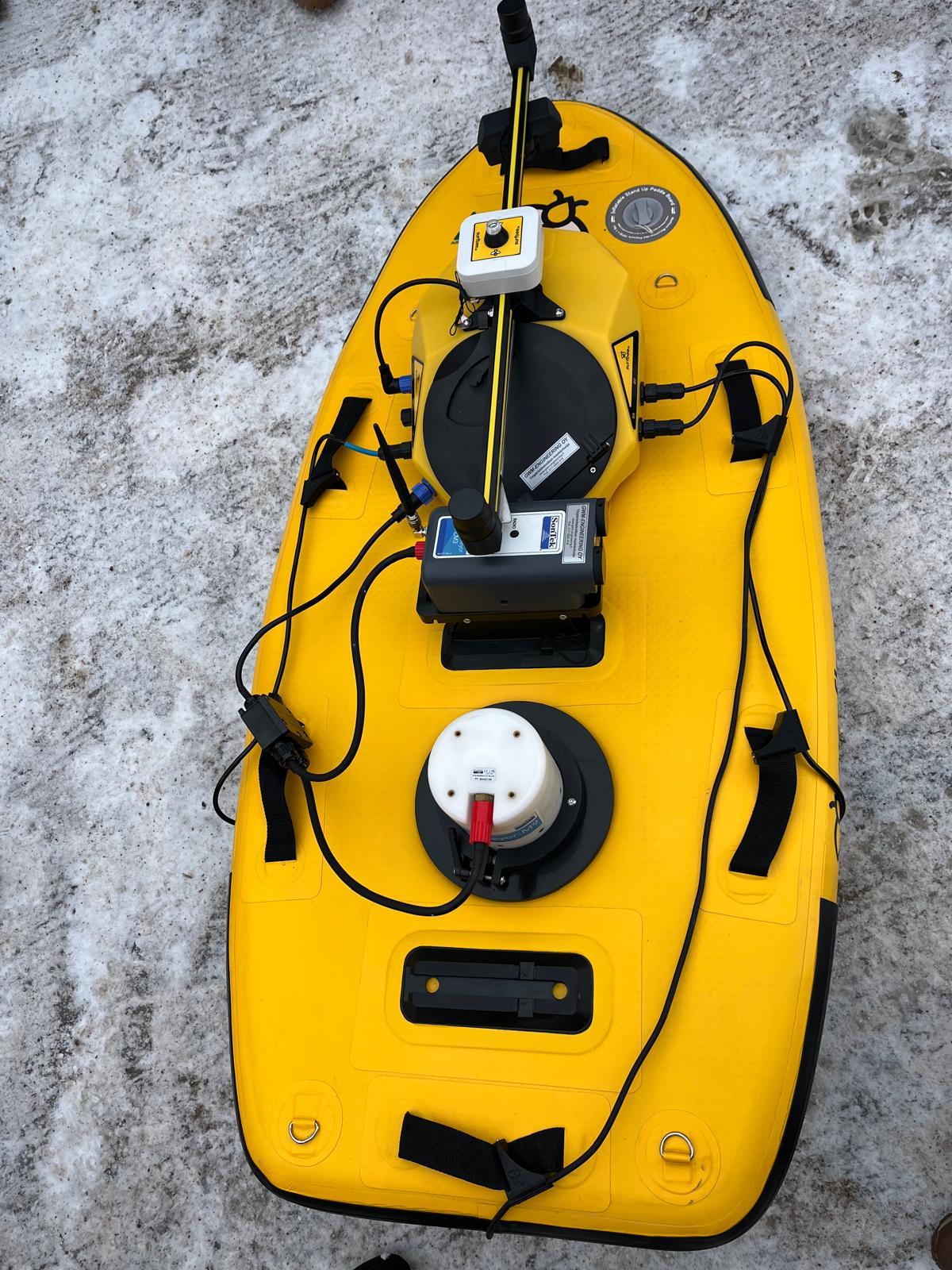
Maveplan has introduced an innovative water flow measurement device that provides a completely new dimension to water research and planning in Finland. This is an automated USV that allows for efficient and accurate data collection even in challenging conditions. Currently, Maveplan is the only Finnish operator utilizing this type of technology.
The device combines automatic control, acoustic Doppler current profiling (ADCP), precise GNSS positioning, autopilot, and a compass. It operates effectively even in demanding environments—from slow-flowing small channels to large rivers with flow speeds of up to four meters per second.
Compared to traditional methods, this technology offers a significantly more efficient and safer alternative, as measurements can be conducted without the need to transport personnel to the site by boat. Thanks to its lightweight design, the device is easy to transport, and its shock-resistant casing ensures reliability even in rocky and difficult-to-navigate water bodies.
Accurate Measurement Data for Clients
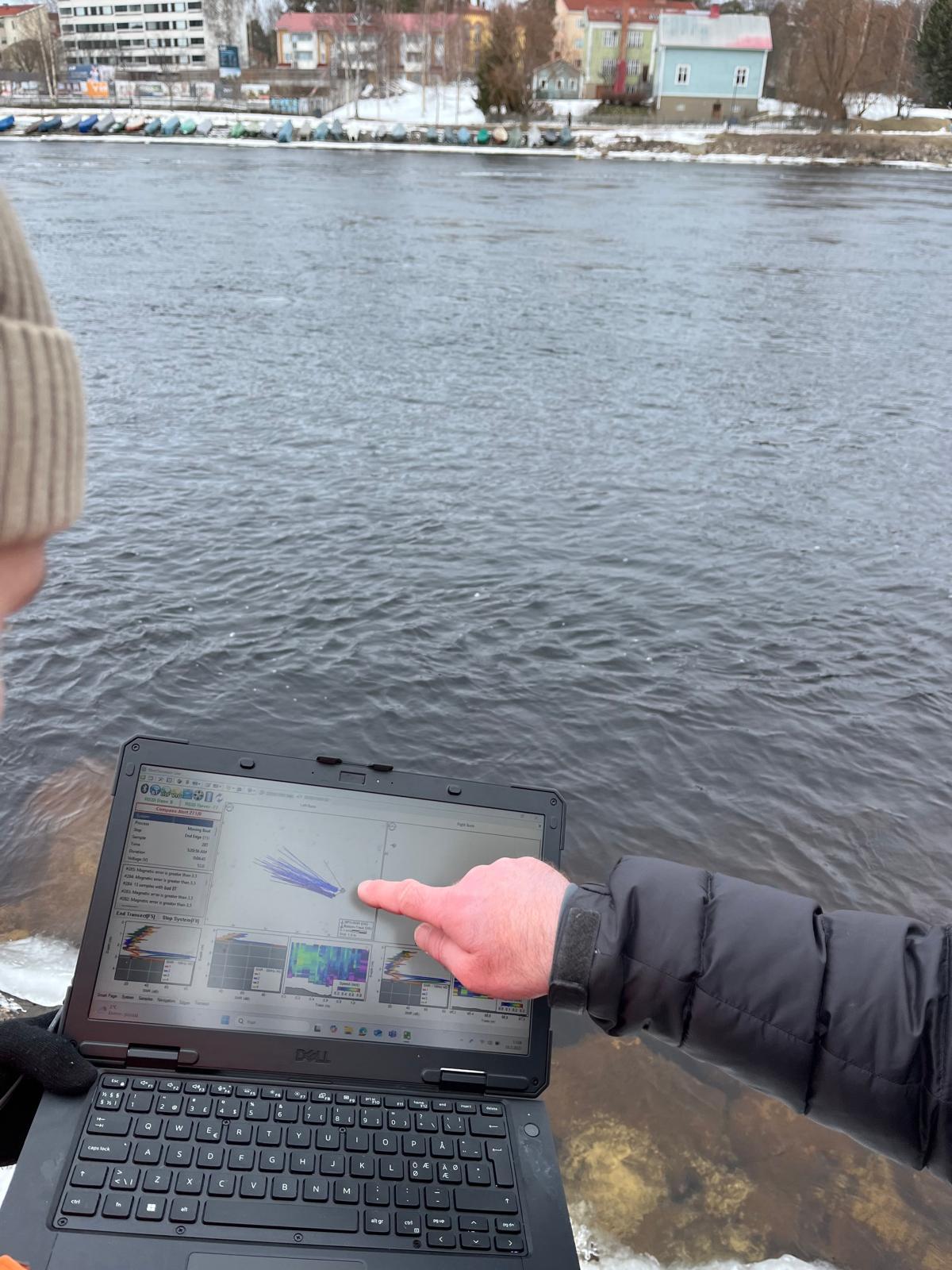
The device provides tangible benefits for clients. The measurement results are more precise than before, as the device is capable of moving across the water’s surface in a completely linear manner and at a consistent speed. Thanks to GPS technology, measurements can be repeated from exactly the same spot, enabling long-term monitoring and reliable comparisons. Additionally, the device can identify changes in riverbed structures that are not easily detectable using traditional methods.
– For example, in fishway design, the accuracy of measurement results is crucial. With this device, we can model flows more accurately and ensure that the fish ladder is positioned at precisely the right spot, explains Maveplan’s sector manager and surveyor, Pyry Tammileivo.
The repeatability of measurements has also significantly improved.
– Previously, measuring at the exact same point was challenging. Now, with the coordinates recorded by the device, measurements can be taken from exactly the same spot time after time.
Versatile Applications and Ongoing Development
The device is suitable for a wide range of applications: flow measurements, the needs of hydropower plants and the mining industry, urban water projects, lake level raise projects, fishway design, and modeling of dammed water bodies. Maveplan’s experts have already utilized the technology in regions such as Ostrobothnia and North Ostrobothnia, where measurements have also been conducted in winter conditions atop the ice.
– We have already successfully conducted measurements at the Merikoski power plant, and the data quality was exceptionally high. This is also a significant step forward in terms safety, as some locations are inaccessible by boat.
In the future, the device could also be used for measuring tailings ponds in the mining industry, where monitoring water volume is critical.
– In such environments, drone technology greatly enhances and accelerates data collection.
If your organization requires precise and reliable information about water bodies to support decision-making or planning, Maveplan’s experts are here to help. Contact us to learn more about our measurement services—we’d be happy to explain how the latest technology can meet your specific needs.
Olli Utriainen
3.4.2025